The YSAR GIS programme
Youth Search and Rescue (YSAR) is supporting the next generation of Geographic Information Systems (GIS) users.
Spatial analysis is an important skill for incident management in many SAR situations. A collaboration between YSAR and New Zealand-based Eagle Technology Ltd is providing access to professional geo-spatial software for the next generation of volunteers. Steve Campbell, CEO of YSAR, says that GIS has been incorporated into the YSAR curriculum since 2009.
“While paper-based maps remain an important backup for field teams, GIS can integrate data from various sources, offering improved situational awareness, efficient resource allocation, real-time tracking, data-driven decision-making, and a platform for seamless collaboration.”
GIS is embedded in the organisation at many levels. Initial training involves YSAR students learning the software, with support from tech-savvy peers and tutors. Projects such as mapping community predator trapping lines and storm damage assess-ments for local councils, give the students real-world challenges, whilst contributing in a meaningful way to their communities.
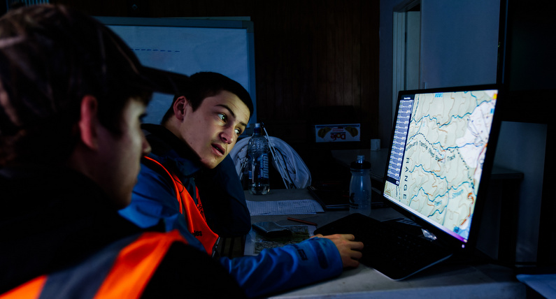
Senior students utilise GIS within incident management roles at YSAR exercises and training camps, both for real-time tracking of field teams, as well as deployment planning and operational control. Incidents, accidents and debriefs from these activities are recorded within the system, aiding lesson management and reinforcing the utility of the tools to the students.
Recent projects have included thermal imagery ortho-mosaic processing, which involves collating a series of high-resolution images into a single large, map-quality image. “These skills have many applications in the search and rescue and emergency man-agement sectors, and YSAR is pleased to be fostering them in the next generation of volunteers.”
Feature image courtesy Adrian Malloch.
Some YSAR branches are planning to work with nearby Land Search and Rescue groups to record and display their geospatial knowledge. This includes the locations of access points, suitable repeater locations, lost party decision points, helicopter landing zones, hazards, sensitive areas and tapu (sacred) sites for iwi. “GIS is a great way of capturing institutional knowledge and supporting the Incident Management Team's need for comprehensive, up-to-date geographical intelligence,” says Steve.
“We began this initiative in the Kaimai Ranges in 2014, and in 2024 hope to expand it through some of our other branches.”
This story was originally published in the April 2024 issue of Link magazine.